this post was submitted on 25 Jan 2024
137 points (96.6% liked)
Climate - truthful information about climate, related activism and politics.
5289 readers
531 users here now
Discussion of climate, how it is changing, activism around that, the politics, and the energy systems change we need in order to stabilize things.
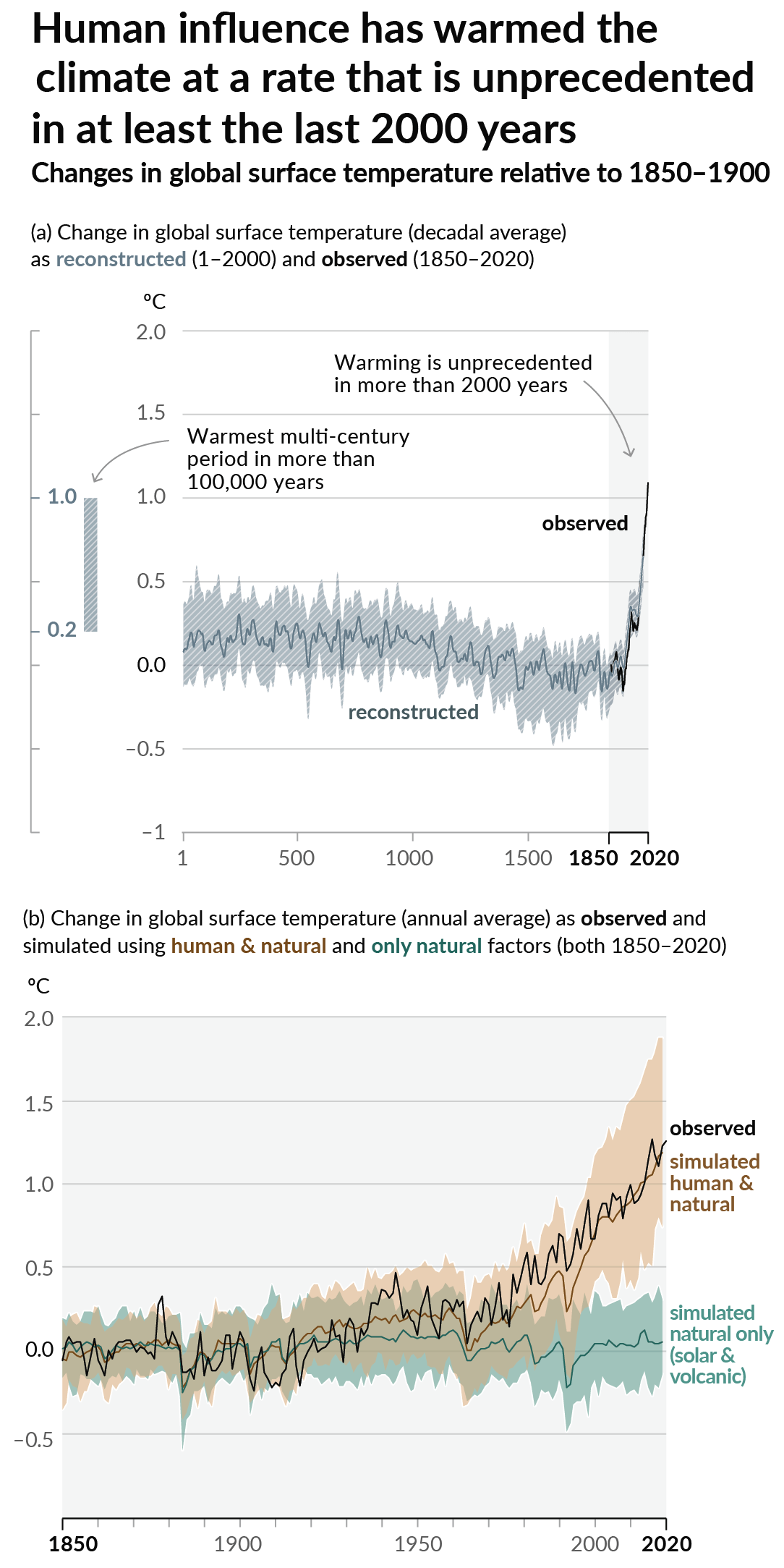
As a starting point, the burning of fossil fuels, and to a lesser extent deforestation and release of methane are responsible for the warming in recent decades:

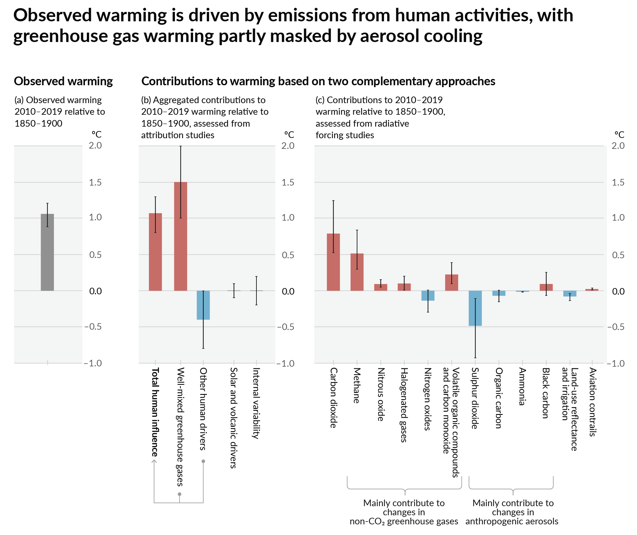
How much each change to the atmosphere has warmed the world:

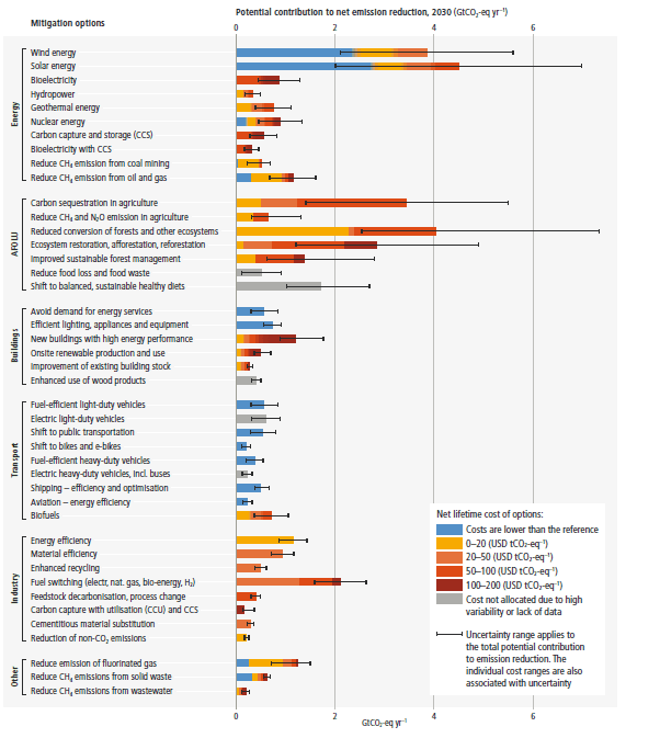
Recommended actions to cut greenhouse gas emissions in the near future:

Anti-science, inactivism, and unsupported conspiracy theories are not ok here.
founded 1 year ago
MODERATORS
you are viewing a single comment's thread
view the rest of the comments
view the rest of the comments

They also made a web app where you can input any city and it will show you its 2080 analog: https://fitzlab.shinyapps.io/cityapp/
Cool idea, but outdated and pretty inaccurate for a lot of areas unfortunately. I’ve seen a few better versions out there.
Do you have some links?
Maybe also something that's not just US only? :-\
I’ll see if I can find what I was looking at. I haven’t seen a really perfect one though. If you want to answer a specific question about your future climate, it’s often best to just look at local predictions.
Thanks for the effort already! :-)
I think this was the best one I had found: https://climate.copernicus.eu/climate-analogues-finding-tomorrows-climate-today
Unfortunately it appears to be broken at the moment. Hopefully that is temporary.
Climate analogues project strong regional differences in the future water and electricity demand across US cities (2023): https://www.cell.com/one-earth/fulltext/S2590-3322(23)00454-2 @climate
#analogs #analogues #climateChange #climate #projections #dataViz #map #maps #classification #USA #DC #LA #SF #SFBA #Chicago #Portland #Seattle #Dallas
An interactive map to show climate analogs in Northern America: https://fitzlab.shinyapps.io/cityapp/ @climate ht @greenhorn
#analogs #analogues #climateChange #climate #projections #dataViz #map #maps #classification #USA #DC #LA #SF #SFBA #Chicago #Portland #Seattle #Dallas #Denver #Toronto
That’s pretty nifty and easy to interpret
And they use OpenStreetMap, pretty cool