The op has it right. Definitely dahlias. I can see why you'd think zinnias though. It's interesting how different (or similar) we can make plants look with dedicated breeding efforts.
Slatlun
joined 3 years ago
Seattle bedazzle
Look up "pink tax" and "gender pay gap".
Are you using https? On mine the app doesn't allow just http.
And broccoli, capers, fennel, lavender, etc
Am I really bathing if I’m using water I cannot drink?
Yes, drinking water is cleaned to the point that it will not make you sick to drink assuming a normal immune system. That is extreme over kill for bathing (and toilets, laundry, etc). The only reason we use drinking water for everything is because infrastructure is expensive and laying non-potable water pipes would cost tons.
Native plant/ecosystem restoration and gardening especially where it intersects edible plants. Also especially around the 45th parallel in N. America.
Yes, and you have to dig deep in some places to get below the frost with your foundation. In those places a basement makes sense because you're digging that far either way. Texas frosts don't get very deep, so you're able to have a shallower foundation making a basement just an extra cost.
Sorry, I shoul've said. The earth isn't a sphere, ellipsoid, or other regular geometric shape. The ocean's surface is less so and changes by the tides. Those shapes can work to model the surface locally and globally depending on accuracy needed but are inherently flawed.
Person 1: Does that matter? Person 2: No, let's just simplify. Person 1: Ok, well we can really simplify using a Mercator projection. Person 2: You're doing it wrong. We need to simplify the part that makes the line not straight, but not so much that it looks bendy again. Our projection needs to be at the level that makes the answer I want to be true look right. Person 1: Does the question even make any sense in this context then?
The earth isn't a sphere though. Even if that has less error it is not none. A geodesic path would also not be straight because of the shape of the earth.
Yes, using lat, long, and radius is better than xyz on the earth - usually. But the radius, the 3rd dimension, changes by where you are because the earth isn't actually a sphere. On this path it would get longer until you reached the equator, shorter until the most southerly point then longer again until you hit NZ. It is a wavy line not a straight one. Again you're projecting 3d onto 2d (because you're incorrectly assuming a fixed radius) and saying that that error in projection doesn't matter.
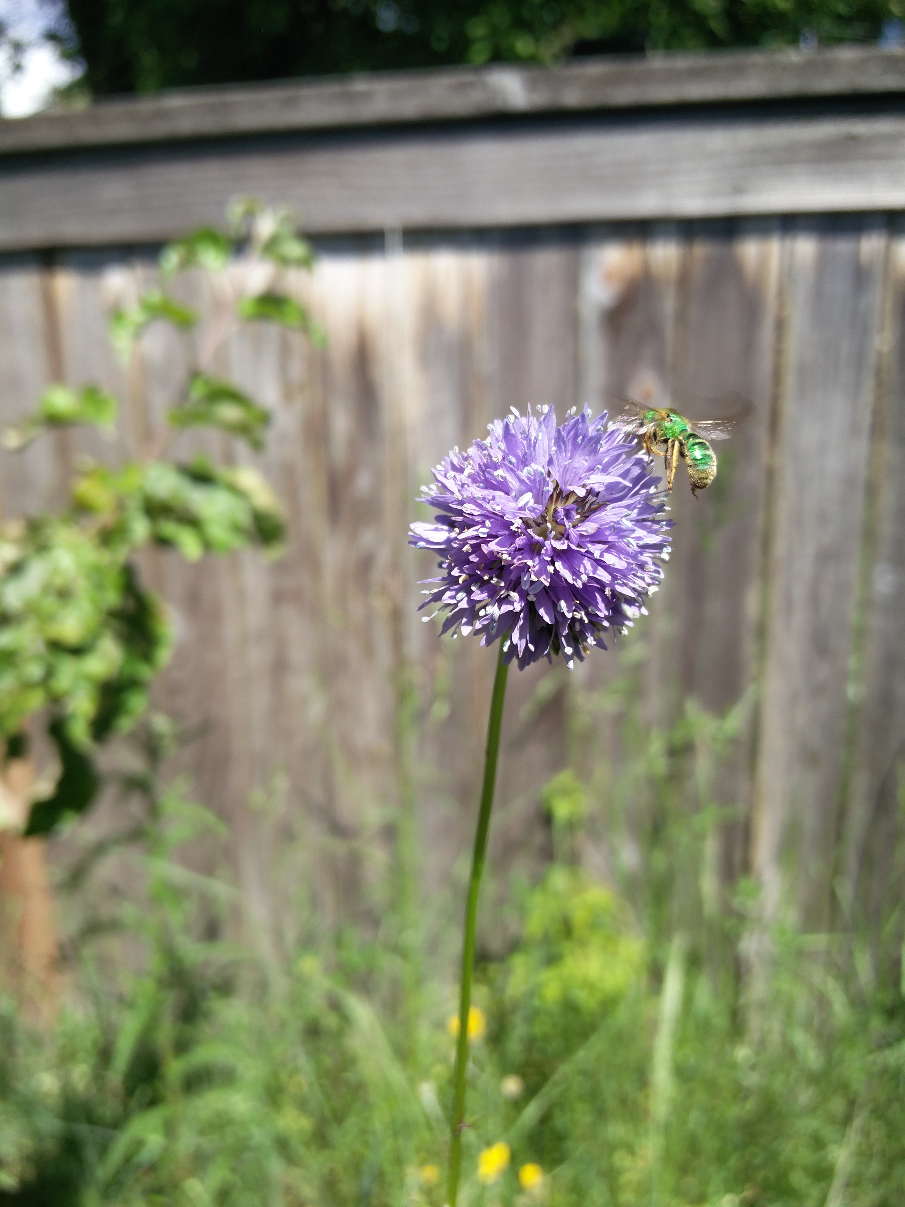
With a sweat bee on it for good measure
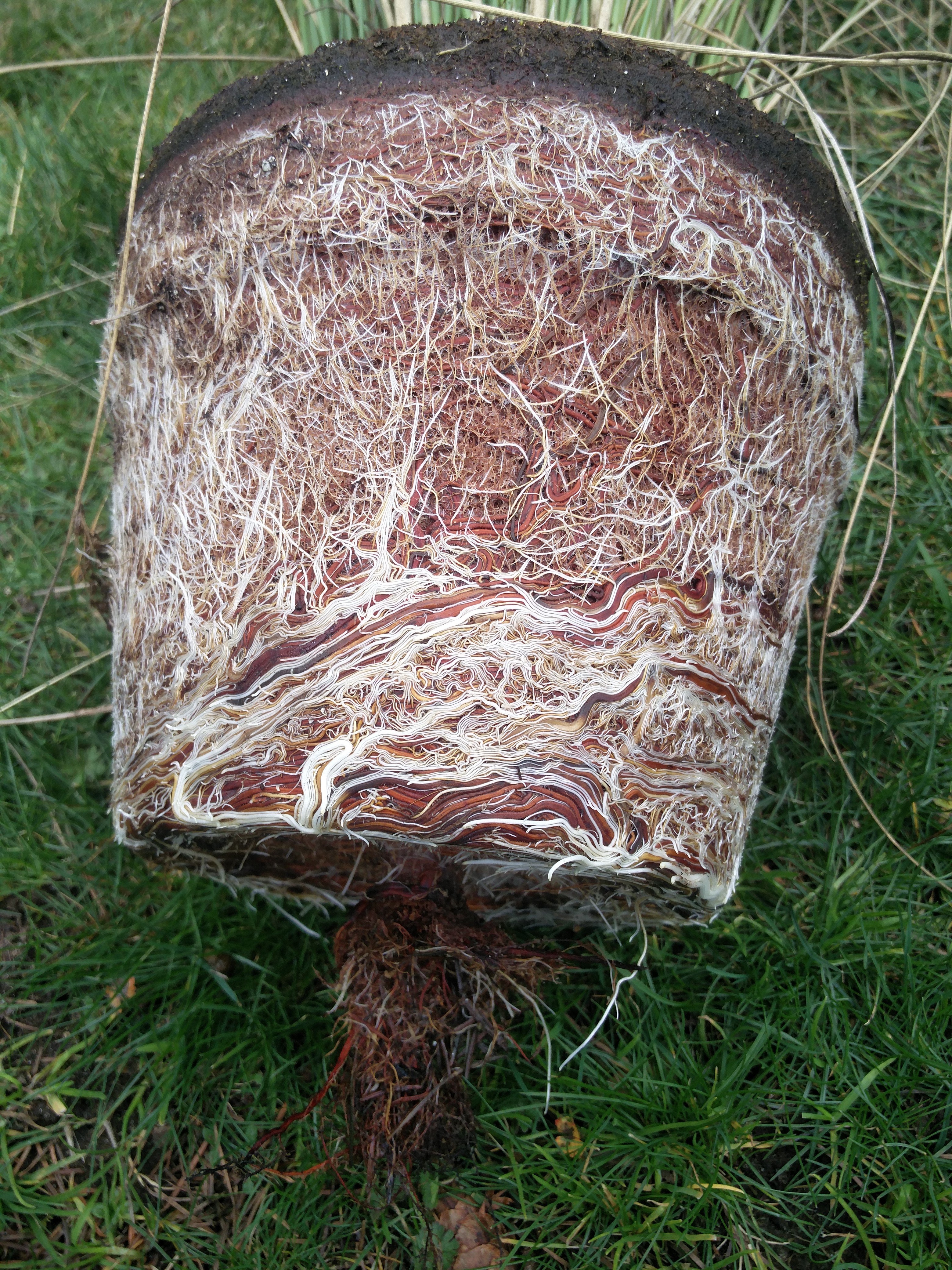
This plant works hard to clean the water I keep out for wildlife. This one grabbed up so much nitrogen/phosphorus that it got pot bound in one year. I split it in half so each half has twice as much room to grow this year.
view more: next ›
Something sweet to pair with the salty. Apple chips, dried fruit, caramel corn, or something like that